
NGI · Airfields & Bridge Decks
See the full picture. Every panel, every pass.
Vehicle-mounted visual distress documentation that captures high-resolution pavement imagery across runways, taxiways, aprons, and bridge decks.
The gap in pavement survey coverage
Traditional pavement surveys sample the surface. Distresses outside the photos go unrecorded.
Partial walkthrough
Inspectors walk representative sections. Ratings are visual and subjective, covering a portion of the total area.
Data gaps accumulate
Distresses between sample sections go undocumented. Year-over-year individual distress comparisons are unreliable or not possible.
Unplanned closure
Missed pavement changes can reach critical severity. Emergency repairs may be required and unplanned closures result.
Stage 2 to 3
Traditional surveys miss individual distress-level comparison, which can indicate different deterioration mechanisms and inform the proper maintenance remediation plan.
Stage 1
Full-surface, RTK-tagged imagery from the entire surface area is processed by AI before distresses have a chance to escalate.
Key capabilities
Full-surface pavement capture with repeatable survey coverage.
Captures day or night
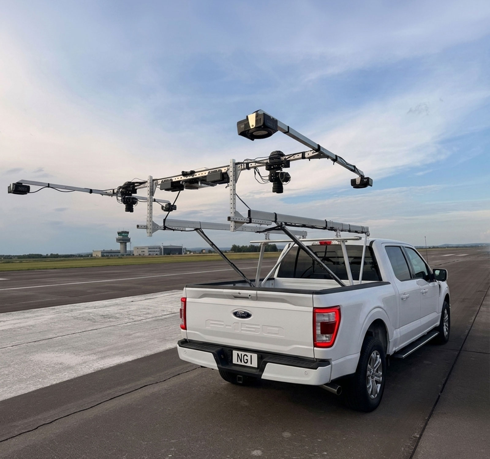
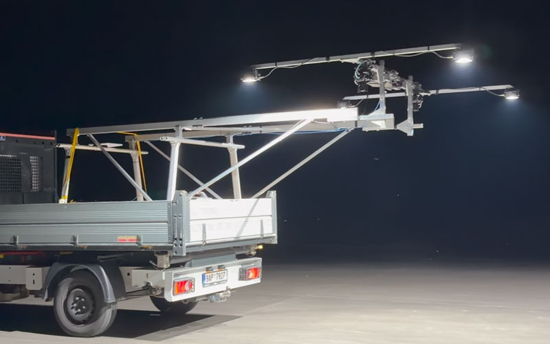
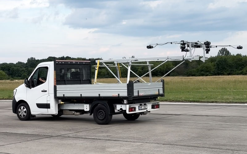
Mounts on a standard vehicle with no special equipment or permits required. Surveys can be completed during off-peak windows, including at night.
Dual cameras with dedicated lighting
Four high-powered spotlights paired with dual high-resolution cameras deliver consistent 1mm/pixel imagery regardless of ambient conditions.
RTK geotagging and live navigation
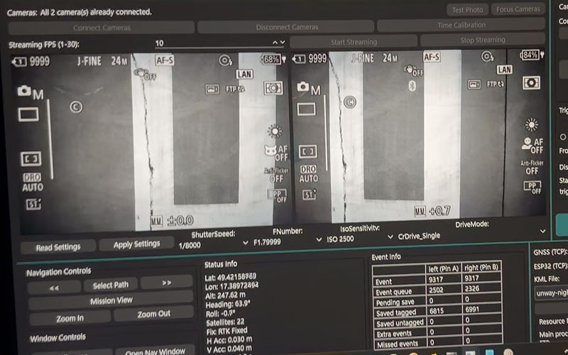
An RTK base station provides centimetre-accurate positioning. Live guidance directs the driver and imaging operator in real time.
AUTOSPEX® integration
Imagery flows into AI-powered processing for geo-referenced defect maps, PCI inputs, orthomosaics, high resolution 3D model and change detection.
The evidence, in AUTOSPEX®
Every defect located. Every panel documented.
Surface Profile Tool in AUTOSPEX® 3D view.
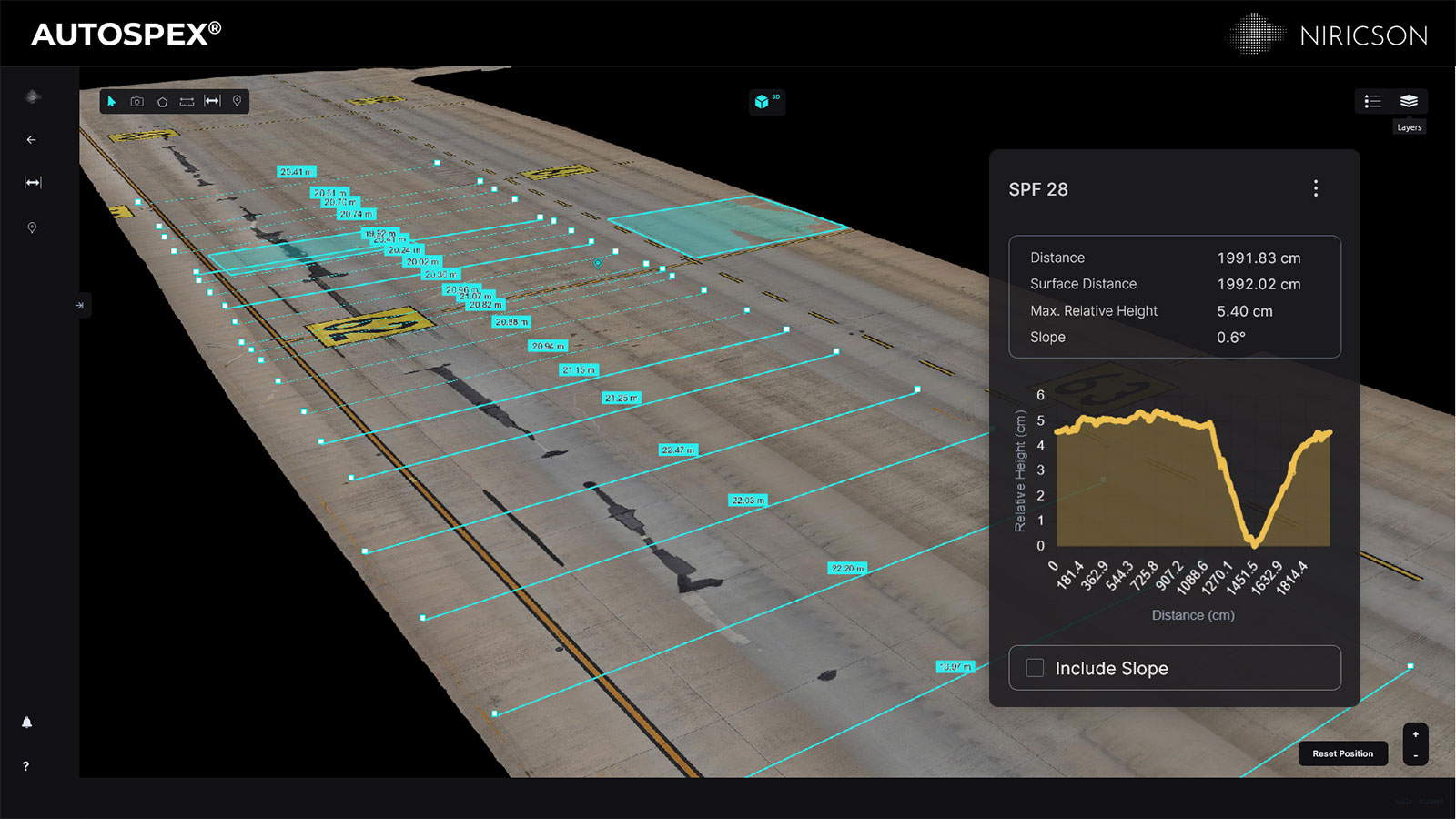
High resolution 3D model
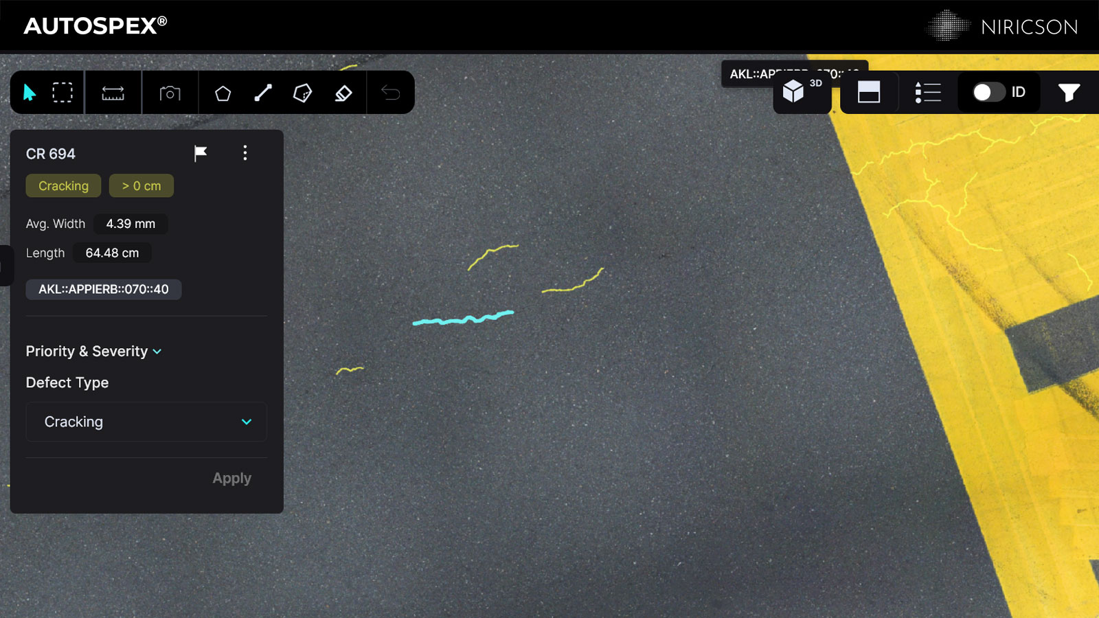
Geo-referenced defect map
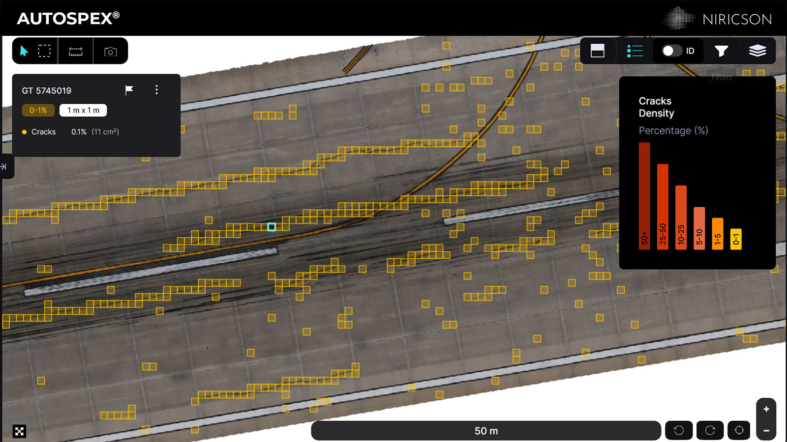
Condition density map
NGI in action
Vehicle-mounted visual distress documentation across large pavement surfaces.
Field to platform in one workflow
RTK-tagged imagery flows into AI-powered AUTOSPEX® processing.
Outputs include geo-referenced defect maps, PCI inputs, orthomosaics, high resolution 3D model, year-over-year change detection, bridge deck ratings, and condition reports.
How NGI works on the runway
Drive. Capture. Map.
Field to platform in one workflow.
Planned vehicle traverse
NGI follows a live-guided inspection route across runways, taxiways, aprons, or bridge deck surfaces. RTK positioning logs a centimetre-accurate ground track throughout.
High-resolution optical imaging
Dual cameras and four high-powered spotlights capture continuous surface imagery as the vehicle moves. Full coverage, every pass, at 1mm/pixel resolution or better.
AUTOSPEX® output
AI-generated defect maps, PCI inputs, bridge deck ratings, and geo-referenced condition reports are delivered through AUTOSPEX for maintenance planning.
Purchase options
Choose the deployment model that fits your inspection team.
Lease
1, 3, or 5-year term lease for your own inspection team. Includes hardware, support, and equipment replacement.
Contact us for a quote.
Niricson as a Service
Niricson's trained field network deploys to your site, collects the data, and delivers fully processed AUTOSPEX outputs.
Contact us for a quote.
Bring objective surface condition data to your next PCI or bridge deck survey.
Get in touch with us and our team will walk you through how NGI supports full-surface pavement documentation and AUTOSPEX delivery.
